The Newfield Inn
Introduction
The photograph on this page of The Newfield Inn by Robert Graham as part of the Geograph project.
The Geograph project started in 2005 with the aim of publishing, organising and preserving representative images for every square kilometre of Great Britain, Ireland and the Isle of Man.

There are currently over 7.5m images from over 14,400 individuals and you can help contribute to the project by visiting https://www.geograph.org.uk
The Newfield Inn
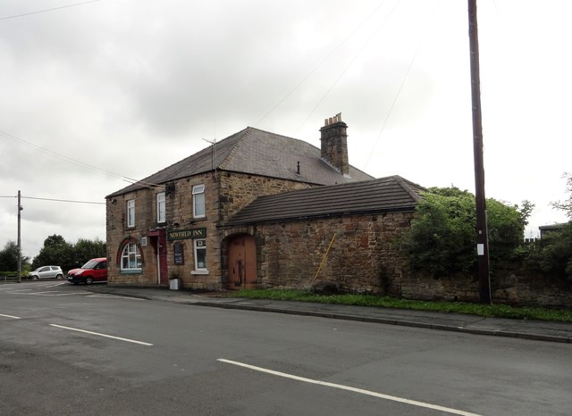
Image: © Robert Graham Taken: 12 Aug 2019
In the village of Pelton Road Ends. It stands on Pelton Lane, at the junction with Newfild Road. Newfield village dates from the second half of the C19, as a pit village. The pub was built then also. The area around the pub is Pelton Lane Ends, another mining community, built at end of the C19 and the early C20. The building still has features from earlier times, for instance the arched opening in the outbuilding on the right, which was probably where the dray waggons went into the yard.
Images are licensed for reuse under creativecommons.org/licenses/by-sa/2.0
Image Location
Latitude
54.865977
Longitude
-1.624015