Temple Manor - Undercroft
Introduction
The photograph on this page of Temple Manor - Undercroft by Rob Farrow as part of the Geograph project.
The Geograph project started in 2005 with the aim of publishing, organising and preserving representative images for every square kilometre of Great Britain, Ireland and the Isle of Man.

There are currently over 7.5m images from over 14,400 individuals and you can help contribute to the project by visiting https://www.geograph.org.uk
Temple Manor - Undercroft
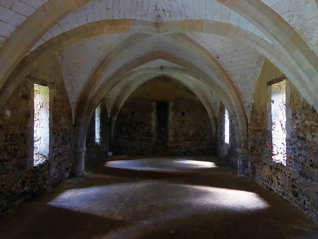
Image: © Rob Farrow Taken: 17 Aug 2019
Temple Manor is supported on an undercroft which has walls nearly 3' (0.8m) thick. It is of three bays (two seen in this image) each of four-sided ribbed vaults, with squared chalk filling between the ribs. This is the earliest part of the building and dates from the C13th. See Image] for more information about the whole building with links to English Heritage information about this Grade I (nationally important) structure. (Also see Image])
Images are licensed for reuse under creativecommons.org/licenses/by-sa/2.0
Image Location


Leaflet Map data © OpenStreetMap
Latitude
51.389346
Longitude
0.489488