Hilltop pasture
Introduction
The photograph on this page of Hilltop pasture by Jonathan Wilkins as part of the Geograph project.
The Geograph project started in 2005 with the aim of publishing, organising and preserving representative images for every square kilometre of Great Britain, Ireland and the Isle of Man.

There are currently over 7.5m images from over 14,400 individuals and you can help contribute to the project by visiting https://www.geograph.org.uk
Hilltop pasture
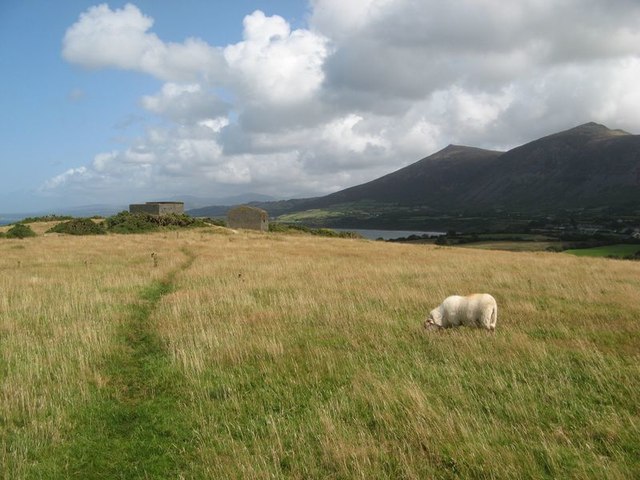
Image: © Jonathan Wilkins Taken: 17 Aug 2019
Sheep grazing the top of Trwyn-y-tâl. I am grateful to Eric Jones for pointing out that the buildings are the remains of a Royal Observer Corps lookout post. It is interesting that they are built with a pressed concrete 'brick' of grey colour, possibly produced here or at Penmaenmawr, both quarries united by the time of World War II under the title of "Penmaenmawr and Welsh Granite Company".
Images are licensed for reuse under creativecommons.org/licenses/by-sa/2.0
Image Location
Latitude
52.996349
Longitude
-4.434827