Ruined Croft above Rovie
Introduction
The photograph on this page of Ruined Croft above Rovie by valenta as part of the Geograph project.
The Geograph project started in 2005 with the aim of publishing, organising and preserving representative images for every square kilometre of Great Britain, Ireland and the Isle of Man.

There are currently over 7.5m images from over 14,400 individuals and you can help contribute to the project by visiting https://www.geograph.org.uk
Ruined Croft above Rovie
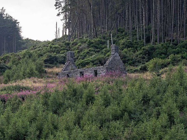
Image: © valenta Taken: 4 Aug 2019
An old croft house, it is marked as Rovie na Craig on the 1906 OS25" map, and also shown without the name on the 1874 OS25" map
Images are licensed for reuse under creativecommons.org/licenses/by-sa/2.0
Image Location
Latitude
57.993898
Longitude
-4.180662