Caol and Lochyside, Scottish Highlands
Introduction
The photograph on this page of Caol and Lochyside, Scottish Highlands by Andrew Tryon as part of the Geograph project.
The Geograph project started in 2005 with the aim of publishing, organising and preserving representative images for every square kilometre of Great Britain, Ireland and the Isle of Man.

There are currently over 7.5m images from over 14,400 individuals and you can help contribute to the project by visiting https://www.geograph.org.uk
Caol and Lochyside, Scottish Highlands
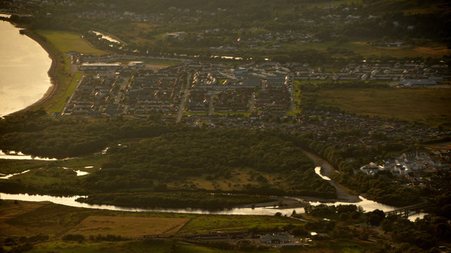
Image: © Andrew Tryon Taken: 30 Jul 2019
The urban conurbations of Caol and Lochyside, Fort william, Scottish Highlands. To the left is Loch Linnhe, a tidal loch. The water 'above' Caol is the Caledonian Canal. The water 'below' is the River Lochy, which has a large island within its estuary.
Images are licensed for reuse under creativecommons.org/licenses/by-sa/2.0
Image Location
Latitude
56.834891
Longitude
-5.094074