Ferguslie Park from the air
Introduction
The photograph on this page of Ferguslie Park from the air by Thomas Nugent as part of the Geograph project.
The Geograph project started in 2005 with the aim of publishing, organising and preserving representative images for every square kilometre of Great Britain, Ireland and the Isle of Man.

There are currently over 7.5m images from over 14,400 individuals and you can help contribute to the project by visiting https://www.geograph.org.uk
Ferguslie Park from the air
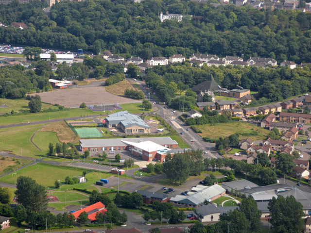
Image: © Thomas Nugent Taken: 15 Jul 2019
The once notorious housing scheme is long gone, replaced by modern housing, schools and public buildings. Glencoats Primary School is prominent, with St Fergus Primary School immediately beyond. Less prominent in the foreground (red brick building with dark grey roof) is Mirren Park School, which is an independent school. Glencoats web site: https://blogs.glowscotland.org.uk/re/glencoatsprimary/ . St Fergus web site: https://blogs.glowscotland.org.uk/re/stfergus/ . Mirren Park web site: https://www.mirrenpark.org/ .
Images are licensed for reuse under creativecommons.org/licenses/by-sa/2.0
Image Location
Latitude
55.849829
Longitude
-4.453483