Llwybr ym Mhont Henri / Path in Pont-Henri
Introduction
The photograph on this page of Llwybr ym Mhont Henri / Path in Pont-Henri by Alan Richards as part of the Geograph project.
The Geograph project started in 2005 with the aim of publishing, organising and preserving representative images for every square kilometre of Great Britain, Ireland and the Isle of Man.

There are currently over 7.5m images from over 14,400 individuals and you can help contribute to the project by visiting https://www.geograph.org.uk
Llwybr ym Mhont Henri / Path in Pont-Henri
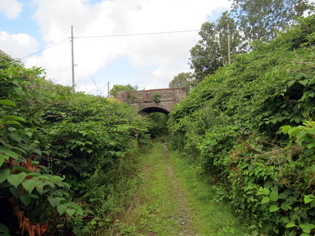
Image: © Alan Richards Taken: 5 Aug 2019
Llwybr cyhoeddys ym Mhont-Henri yn agosau at bont reilffordd. Mae un o gledrau'r hen reilffordd i'w weld ymhlith y tyfiant. A public footpath at Pont-Henry (trans. Henry's bridge) approaching the railway bridge. One of the railway tracks is visible amongst the undergrowth.
Images are licensed for reuse under creativecommons.org/licenses/by-sa/2.0
Image Location
Latitude
51.761696
Longitude
-4.208682