Irish ferry traffic in Maybole
Introduction
The photograph on this page of Irish ferry traffic in Maybole by Mary and Angus Hogg as part of the Geograph project.
The Geograph project started in 2005 with the aim of publishing, organising and preserving representative images for every square kilometre of Great Britain, Ireland and the Isle of Man.

There are currently over 7.5m images from over 14,400 individuals and you can help contribute to the project by visiting https://www.geograph.org.uk
Irish ferry traffic in Maybole
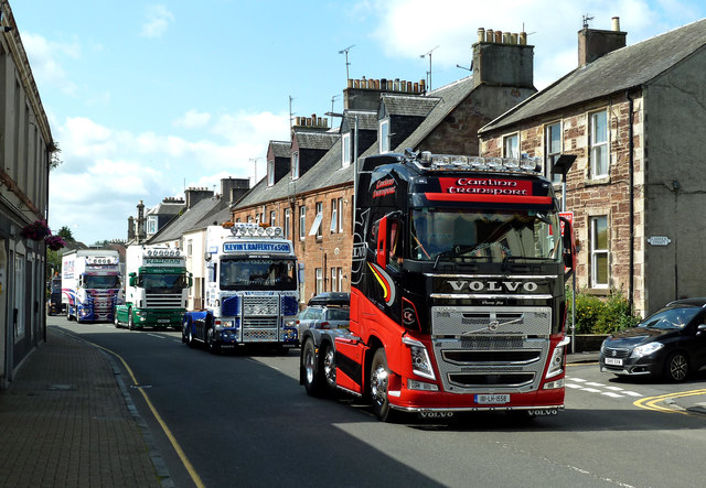
Image: © Mary and Angus Hogg Taken: 2 Aug 2019
A convoy of lorries from the ferry terminals at Cairnryan passing through Maybole on the A77. The problem is caused partly by the volume of traffic, especially to and from the ferries, and partly by the increased size of the heavy vehicles. Local traffic and large farm vehicles add to the complexity of the situation here. Thankfully, work has started on the long-awaited by-pass.
Images are licensed for reuse under creativecommons.org/licenses/by-sa/2.0
Image Location
Latitude
55.352681
Longitude
-4.684676