Air Raid Shelter, Donaghadee
Introduction
The photograph on this page of Air Raid Shelter, Donaghadee by Rossographer as part of the Geograph project.
The Geograph project started in 2005 with the aim of publishing, organising and preserving representative images for every square kilometre of Great Britain, Ireland and the Isle of Man.

There are currently over 7.5m images from over 14,400 individuals and you can help contribute to the project by visiting https://www.geograph.org.uk
Air Raid Shelter, Donaghadee
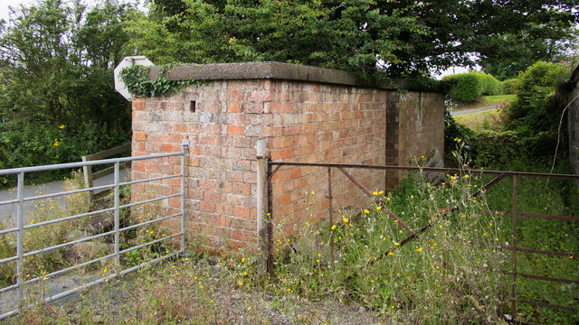
Image: © Rossographer Taken: 2 Aug 2019
WW2 air raid shelter on the corner of the Ballyvester and Millisle roads on the southern side of Donaghadee. Possibly under threat of removal as the site it sits on appears to be for sale (see https://www.johnminnis.co.uk/property/donaghadee/jmdjmd13730/1-ballyvester-road/ ).
Images are licensed for reuse under creativecommons.org/licenses/by-sa/2.0
Image Location
Latitude
54.627539
Longitude
-5.533625