Terraced housing on Framwellgate Peth
Introduction
The photograph on this page of Terraced housing on Framwellgate Peth by Trevor Littlewood as part of the Geograph project.
The Geograph project started in 2005 with the aim of publishing, organising and preserving representative images for every square kilometre of Great Britain, Ireland and the Isle of Man.

There are currently over 7.5m images from over 14,400 individuals and you can help contribute to the project by visiting https://www.geograph.org.uk
Terraced housing on Framwellgate Peth
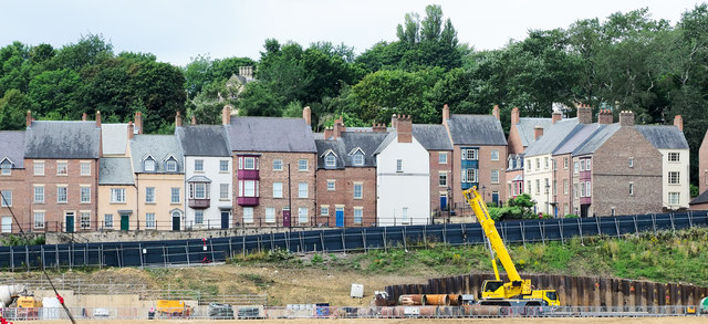
Image: © Trevor Littlewood Taken: 3 Aug 2019
The actual road, Framwellgate Peth, the A691, is hidden by the line of fencing which is in place to keep secure the site of the Milburngate development in Durham. The housing is a terrace in that the individual properties are all connected but unusual in that no two are alike.
Images are licensed for reuse under creativecommons.org/licenses/by-sa/2.0
Image Location
Latitude
54.778843
Longitude
-1.579736