
Thatched shelter
Introduction
The photograph on this page of Thatched shelter by Evelyn Simak as part of the Geograph project.
The Geograph project started in 2005 with the aim of publishing, organising and preserving representative images for every square kilometre of Great Britain, Ireland and the Isle of Man.

There are currently over 7.5m images from over 14,400 individuals and you can help contribute to the project by visiting https://www.geograph.org.uk
Thatched shelter
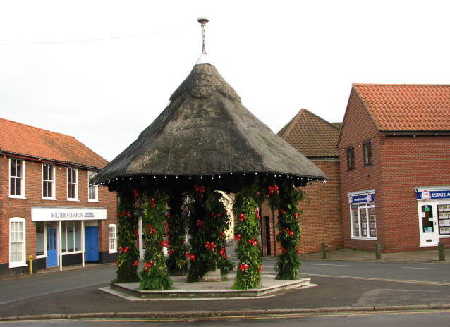
Image: © Evelyn Simak Taken: 28 Nov 2007
This octagonal thatched shelter, decorated for the festive season in late November, was erected in 1913. It is situated in the middle of the Cawston Road - Penfold Street junction; the view is east towards Penfold Street. This shelter houses the John Soame Memorial Pump. Before the event of a public water supply in 1933, water had to be drawn from private wells. The pump is named after John Soame, who was a councillor in Aylsham in 1894. After his death in 1911, a public well, pump and shelter was given to the town by his nephew, John Soame Austin, a wealthy financier born in Aylsham. The artesian well is 52 metres (170 ft) deep and its roof is thatched with Norfolk reed.
Images are licensed for reuse under creativecommons.org/licenses/by-sa/2.0
Image Location

Latitude
52.795207
Longitude
1.249534