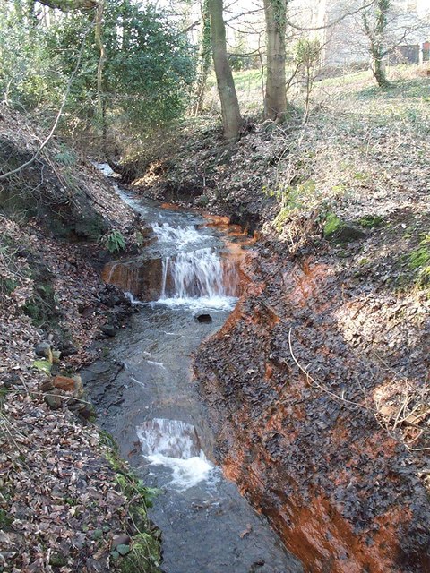
'Brick Houses Brook' near Limb Lane, Sheffield
Introduction
The photograph on this page of 'Brick Houses Brook' near Limb Lane, Sheffield by S Dumpleton as part of the Geograph project.
The Geograph project started in 2005 with the aim of publishing, organising and preserving representative images for every square kilometre of Great Britain, Ireland and the Isle of Man.
There are currently over 7.5m images from over 14,400 individuals and you can help contribute to the project by visiting https://www.geograph.org.uk

Image: © S Dumpleton Taken: Unknown
The 'Brick Houses Brook'is an unofficial name for the otherwise un-named brook which rises from Brick Houses just north of Dore, south west Sheffield, and flows eastwards through Ryecroft Glen, before joining the Limb Brook in Ecclesall Woods. At the camera location the brook flows into a stone-lined culvert beneath the landscaped old spoil heaps of the former Moss Ganister Mine (worked from late 19th century until 1940s) where it is joined by drainage from the old mine workings, and eventually emerging again from a concrete pipe in Ryecroft Glen. However, the ochrous staining visible in the photo appears to be natural (i.e. not related to mine workings) caused by water seepage through, and oxidation of, the pyritic shales which form the river bank at this point.

