Keptie Hills esker, Arbroath, Scotland
Introduction
The photograph on this page of Keptie Hills esker, Arbroath, Scotland by S Dumpleton as part of the Geograph project.
The Geograph project started in 2005 with the aim of publishing, organising and preserving representative images for every square kilometre of Great Britain, Ireland and the Isle of Man.

There are currently over 7.5m images from over 14,400 individuals and you can help contribute to the project by visiting https://www.geograph.org.uk
Keptie Hills esker, Arbroath, Scotland
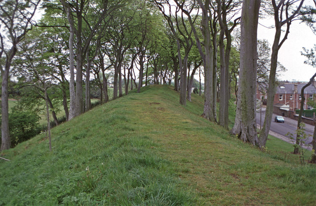
Image: © S Dumpleton Taken: 17 May 1997
The Keptie Hills in Arbroath is a good example of an esker. Eskers are formed from rock debris deposited by meltwater in a sub-glacial meltwater tunnel. The confines of the glacier ice means that the deposits are closely constrained and tend to build upwards rather than spreading out. When the glacier finally melts away, the esker is left as a sinuous ridge of gravel and sand. They often superficially resemble railway embankents and can be many miles long. Scanned from Kodachrome 64 transparency film, taken with a Zenit 'E'.
Images are licensed for reuse under creativecommons.org/licenses/by-sa/2.0
Image Location
Latitude
56.562856
Longitude
-2.597443