Ancient hedgebank in Chaddlewood
Introduction
The photograph on this page of Ancient hedgebank in Chaddlewood by Nigel Mole as part of the Geograph project.
The Geograph project started in 2005 with the aim of publishing, organising and preserving representative images for every square kilometre of Great Britain, Ireland and the Isle of Man.

There are currently over 7.5m images from over 14,400 individuals and you can help contribute to the project by visiting https://www.geograph.org.uk
Ancient hedgebank in Chaddlewood
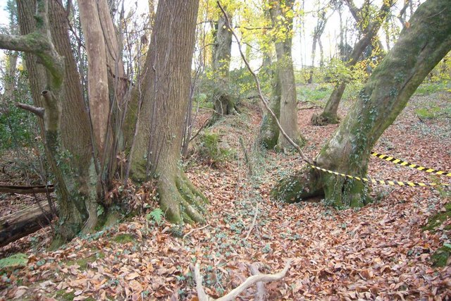
Image: © Nigel Mole Taken: 25 Nov 2007
This is one of three hedgebanks that are shown on the 1:25000 OS map, which run North-South. They are presumably field boundaries that pre-date the planting of the wood. They are also mirrored on the other side of the railway suggesting that they were cut through when the line was built to Plymouth in 1849.
Images are licensed for reuse under creativecommons.org/licenses/by-sa/2.0
Image Location
Latitude
50.392574
Longitude
-4.022987