View of the former Winnocks Charity almshouses on Military Road
Introduction
The photograph on this page of View of the former Winnocks Charity almshouses on Military Road by Robert Lamb as part of the Geograph project.
The Geograph project started in 2005 with the aim of publishing, organising and preserving representative images for every square kilometre of Great Britain, Ireland and the Isle of Man.

There are currently over 7.5m images from over 14,400 individuals and you can help contribute to the project by visiting https://www.geograph.org.uk
View of the former Winnocks Charity almshouses on Military Road
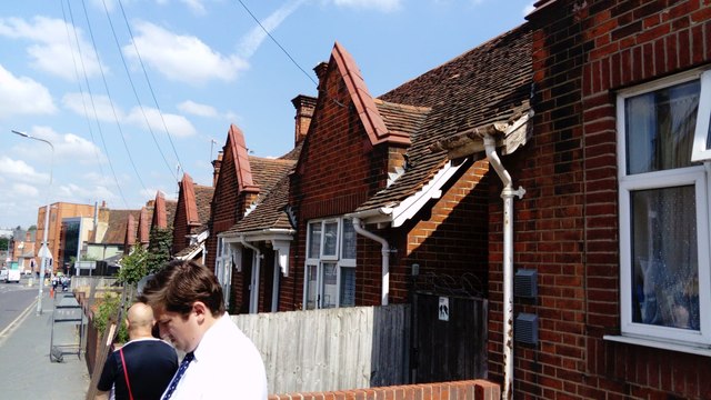
Image: © Robert Lamb Taken: 16 Jul 2019
These almshouses are now bungalows. According to a plaque on the bungalow nearest the camera, the almshouses were built and funded by George Rose in 1933. Looking north-northwest.
Images are licensed for reuse under creativecommons.org/licenses/by-sa/2.0
Image Location
Latitude
51.885386
Longitude
0.906147