Duns Parish Church
Introduction
The photograph on this page of Duns Parish Church by Russel Wills as part of the Geograph project.
The Geograph project started in 2005 with the aim of publishing, organising and preserving representative images for every square kilometre of Great Britain, Ireland and the Isle of Man.

There are currently over 7.5m images from over 14,400 individuals and you can help contribute to the project by visiting https://www.geograph.org.uk
Duns Parish Church
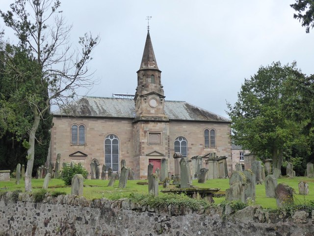
Image: © Russel Wills Taken: 11 Jul 2019
Standing in the heart of Berwickshire's county town. Most of the building dates from 1880, replacing the previous church which burnt down the year before, although the spire goes back to 1790.
Images are licensed for reuse under creativecommons.org/licenses/by-sa/2.0
Image Location
Latitude
55.777588
Longitude
-2.342409