Information Board at Ver Valley Meadows
Introduction
The photograph on this page of Information Board at Ver Valley Meadows by David Hillas as part of the Geograph project.
The Geograph project started in 2005 with the aim of publishing, organising and preserving representative images for every square kilometre of Great Britain, Ireland and the Isle of Man.

There are currently over 7.5m images from over 14,400 individuals and you can help contribute to the project by visiting https://www.geograph.org.uk
Information Board at Ver Valley Meadows
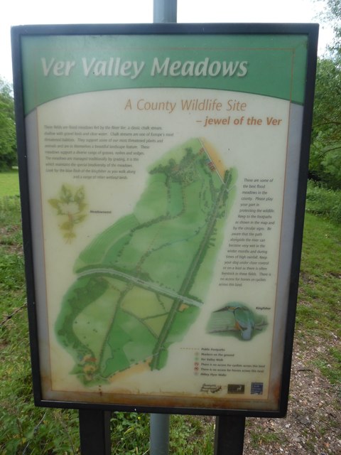
Image: © David Hillas Taken: 30 May 2019
This information board is located on the Abbey Line Trail between Frogmore and Sopwell https://www.walkingenglishman.com/ldp/abbeylinetrail.html refers, and shows a map of the meadows. It has the following wording: A County Wildlife Site - jewel of the Ver Left side These fields are flood meadows fed by the River Ver, a classic chalk stream, shallow with gravel beds and clear water. Chalk streams are one of Europe's most threatened habitats. They support some of our most threatened plants and animals and are in themselves a beautiful landscape feature. These meadows support a diverse range of grasses, rushes and sedges. The meadows are managed traditionally by grazing, it is this which maintains the special biodiversity of the meadows. Look for the blue flash of the kingfisher as you walk along and a range of other wetland birds. Right side These are some of the best flood meadows in the county. Please play your part in protecting the wildlife. Keep to the footpaths as shown in the map and by the circular signs. Be aware that the path alongside the river can become very wet in the winter months and during times of high rainfall. Keep your dog under close control or on a lead as there is often livestock in these fields. There is no access for horses or cyclists across this land. On the left side of the board is an image of the meadowsweet plant whilst on the right side there is an image of a kingfisher bird.
Images are licensed for reuse under creativecommons.org/licenses/by-sa/2.0
Image Location
Latitude
51.728999
Longitude
-0.332661