Under dwellings, Holmfirth, Yorkshire
Introduction
The photograph on this page of Under dwellings, Holmfirth, Yorkshire by Dr Neil Clifton as part of the Geograph project.
The Geograph project started in 2005 with the aim of publishing, organising and preserving representative images for every square kilometre of Great Britain, Ireland and the Isle of Man.

There are currently over 7.5m images from over 14,400 individuals and you can help contribute to the project by visiting https://www.geograph.org.uk
Under dwellings, Holmfirth, Yorkshire
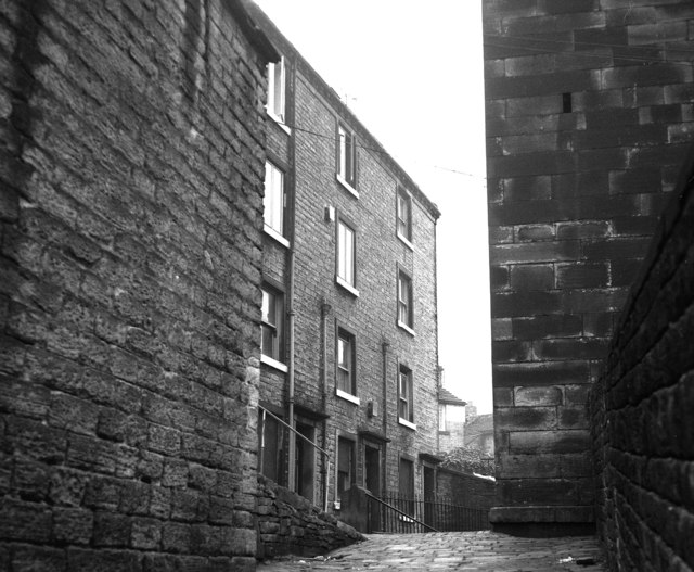
Image: © Dr Neil Clifton Taken: 6 Apr 1982
On the left are two rows of houses, one row physically below the other. The bottom row have no back doors. The top row have front doors on the other side, but no back doors, clearly. There are five houses in each row, but the nearer two pairs are out of view behind the wall on the left. The upper houses can be seen on Image and Image The whole of these buildings had been demolished by about 2004.
Images are licensed for reuse under creativecommons.org/licenses/by-sa/2.0
Image Location
Latitude
53.569321
Longitude
-1.788565