Burrell's Folly, Drumquin
Introduction
The photograph on this page of Burrell's Folly, Drumquin by Kenneth Allen as part of the Geograph project.
The Geograph project started in 2005 with the aim of publishing, organising and preserving representative images for every square kilometre of Great Britain, Ireland and the Isle of Man.

There are currently over 7.5m images from over 14,400 individuals and you can help contribute to the project by visiting https://www.geograph.org.uk
Burrell's Folly, Drumquin
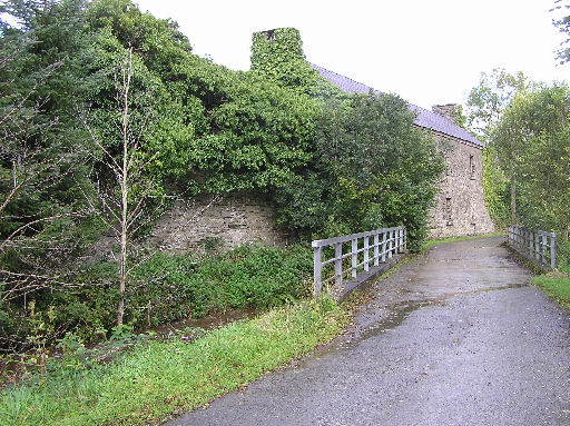
Image: © Kenneth Allen Taken: 28 Sep 2005
It was built beside a stream behind the main road on the Omagh side of the village in 1779 by Robert Sproule at a cost of £350 (now demolished) The fine office houses on the banks of the Drumquin Water which were built by Edward Sproule in 1832 still remain.
Images are licensed for reuse under creativecommons.org/licenses/by-sa/2.0
Image Location


Leaflet Map data © OpenStreetMap
Latitude
54.609555
Longitude
-7.491587