WWII Cheshire: RNAS Stretton, Compass Swing Base
Introduction
The photograph on this page of WWII Cheshire: RNAS Stretton, Compass Swing Base by Mike Searle as part of the Geograph project.
The Geograph project started in 2005 with the aim of publishing, organising and preserving representative images for every square kilometre of Great Britain, Ireland and the Isle of Man.

There are currently over 7.5m images from over 14,400 individuals and you can help contribute to the project by visiting https://www.geograph.org.uk
WWII Cheshire: RNAS Stretton, Compass Swing Base
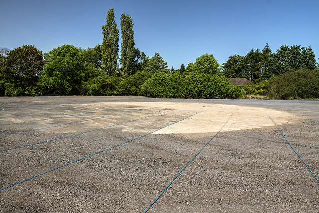
Image: © Mike Searle Taken: 28 Jun 2019
A circular concrete hard standing on which aircraft were positioned. Used to accurately adjust aircraft magnetic compasses. Currently the site is being prepared for use as a car park, the lines of blue rope being used to mark out the parking lanes. START: Image
Images are licensed for reuse under creativecommons.org/licenses/by-sa/2.0
Image Location
Latitude
53.347828
Longitude
-2.512642