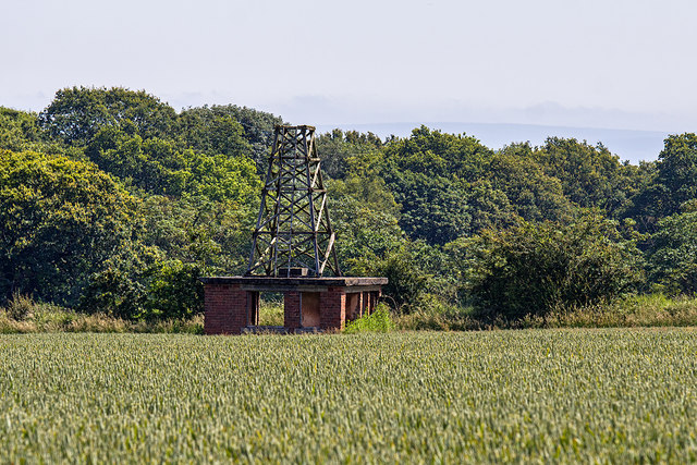
WWII Cheshire: RNAS Stretton, VHF Homing beacon
Introduction
The photograph on this page of WWII Cheshire: RNAS Stretton, VHF Homing beacon by Mike Searle as part of the Geograph project.
The Geograph project started in 2005 with the aim of publishing, organising and preserving representative images for every square kilometre of Great Britain, Ireland and the Isle of Man.
There are currently over 7.5m images from over 14,400 individuals and you can help contribute to the project by visiting https://www.geograph.org.uk

Image: © Mike Searle Taken: 28 Jun 2019
Used as a navigational aid for returning aircraft to the airfield, this small brick building would have housed direction finding equipment. The concrete roof supports a wooden lattice tower having an access ladder for maintenance of the radio antenna. Quite amazing that it's still standing after all these years, although unsurprisingly the wood does appear visibly weathered. Image

