Auchamore Farm Steading
Introduction
The photograph on this page of Auchamore Farm Steading by Thomas Nugent as part of the Geograph project.
The Geograph project started in 2005 with the aim of publishing, organising and preserving representative images for every square kilometre of Great Britain, Ireland and the Isle of Man.

There are currently over 7.5m images from over 14,400 individuals and you can help contribute to the project by visiting https://www.geograph.org.uk
Auchamore Farm Steading
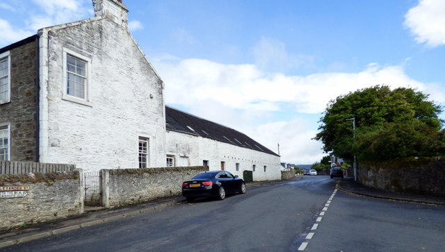
Image: © Thomas Nugent Taken: 1 Jul 2019
Category B Listed http://portal.historicenvironment.scot/designation/LB26446 , built on the site of the thatched cottage where Mary Campbell (Highland Mary of Burns fame) was born. A plaque on a boundary wall marks this spot. This is the Alexander Street side of the steading.
Images are licensed for reuse under creativecommons.org/licenses/by-sa/2.0
Image Location
Latitude
55.94739
Longitude
-4.936198