Southampton - Canute's Palace
Introduction
The photograph on this page of Southampton - Canute's Palace by Rob Farrow as part of the Geograph project.
The Geograph project started in 2005 with the aim of publishing, organising and preserving representative images for every square kilometre of Great Britain, Ireland and the Isle of Man.

There are currently over 7.5m images from over 14,400 individuals and you can help contribute to the project by visiting https://www.geograph.org.uk
Southampton - Canute's Palace
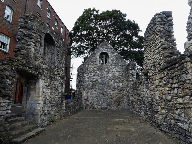
Image: © Rob Farrow Taken: 30 Jun 2019
Just as with Image] this "palace" is completely misnamed, as rather than being a palace dating back to the Danish Cnut's time (reigned 1016-1035), it is in fact the remains of a late C12th merchant's house. It is of the "upper hall-house" type. It is to be found on Porters Lane, a small back-lane that runs parallel with Town Quay. See EH Grade I listing here: https://historicengland.org.uk/listing/the-list/list-entry/1340013 On the other side of Porters Lane stands Image]
Images are licensed for reuse under creativecommons.org/licenses/by-sa/2.0
Image Location
Latitude
50.896962
Longitude
-1.404869