Rye Hill, Rye and Playden
Introduction
The photograph on this page of Rye Hill, Rye and Playden by Simon Carey as part of the Geograph project.
The Geograph project started in 2005 with the aim of publishing, organising and preserving representative images for every square kilometre of Great Britain, Ireland and the Isle of Man.

There are currently over 7.5m images from over 14,400 individuals and you can help contribute to the project by visiting https://www.geograph.org.uk
Rye Hill, Rye and Playden
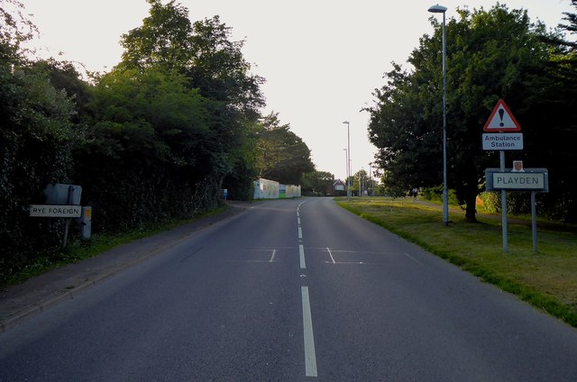
Image: © Simon Carey Taken: 27 Jun 2019
The road signs back up the parish boundary arrangements here, all buildings on the western side are in Rye all those to the east belong to Playden. Rye Foreign is an old medieval term for an area north of the town that still remained in the French Abbey of Fecamp's hands after 1247.
Images are licensed for reuse under creativecommons.org/licenses/by-sa/2.0
Image Location
Latitude
50.961026
Longitude
0.732413