Kilbirnie North from Glengarnock
Introduction
The photograph on this page of Kilbirnie North from Glengarnock by Mark S as part of the Geograph project.
The Geograph project started in 2005 with the aim of publishing, organising and preserving representative images for every square kilometre of Great Britain, Ireland and the Isle of Man.

There are currently over 7.5m images from over 14,400 individuals and you can help contribute to the project by visiting https://www.geograph.org.uk
Kilbirnie North from Glengarnock
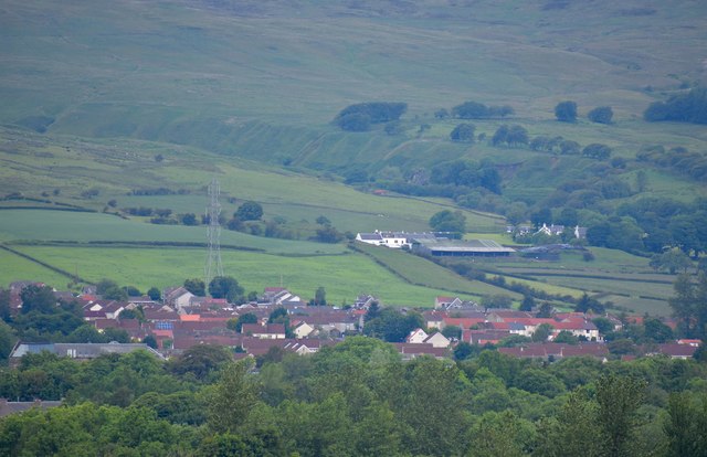
Image: © Mark S Taken: 22 Jun 2019
The houses closest to the camera are situated in the Milton scheme, with Herriot Avenue behind. Beyond lies Greenridge and Kaimhill and in the distance, the ruins of the 15th century Glengarnock Castle. The River Garnock flows in the deep ravine running along the top of the picture.
Images are licensed for reuse under creativecommons.org/licenses/by-sa/2.0
Image Location
Latitude
55.775347
Longitude
-4.692469