Water conduit head on Ludlow Road
Introduction
The photograph on this page of Water conduit head on Ludlow Road by Richard Law as part of the Geograph project.
The Geograph project started in 2005 with the aim of publishing, organising and preserving representative images for every square kilometre of Great Britain, Ireland and the Isle of Man.

There are currently over 7.5m images from over 14,400 individuals and you can help contribute to the project by visiting https://www.geograph.org.uk
Water conduit head on Ludlow Road
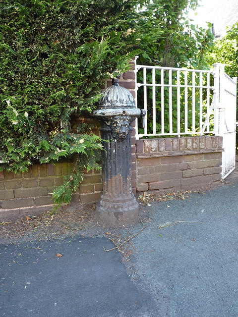
Image: © Richard Law Taken: 21 Jun 2019
This Grade II listed https://britishlistedbuildings.co.uk/101392279-conduit-head-corner-of-westgate-and-ludlow-road-bridgnorth#.XRieM-hKjct & https://historicengland.org.uk/listing/the-list/list-entry/1392279 black pipehead represents a visible portion of the mid-19th century public water supply system installed throughout Bridgnorth from the 1850s onwards. The basis of the system was a pumped arrangement to bring water from the Severn to a filtration works above the town. This was connected to a network of pipes extending through the town, and dispensed through conduit heads such as this in a variety of strategic locations. A couple survive - the one seen here, and another listed one in the middle of the town at Image There is also a similar (pump-handled) head to the north of Low Town, now demoted to a decorative feature in a flowerbed near the junction of Stanley Lane and Bramble Ridge.
Images are licensed for reuse under creativecommons.org/licenses/by-sa/2.0
Image Location
Latitude
52.535944
Longitude
-2.429696