Stoke Fleming: Riversbridge
Introduction
The photograph on this page of Stoke Fleming: Riversbridge by Martin Bodman as part of the Geograph project.
The Geograph project started in 2005 with the aim of publishing, organising and preserving representative images for every square kilometre of Great Britain, Ireland and the Isle of Man.

There are currently over 7.5m images from over 14,400 individuals and you can help contribute to the project by visiting https://www.geograph.org.uk
Stoke Fleming: Riversbridge
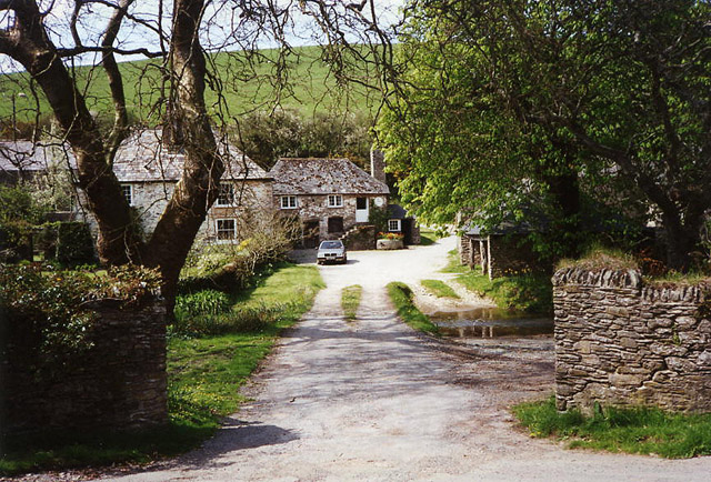
Image: © Martin Bodman Taken: 5 May 1996
Once a farm and now, it appears, a private residence. A bridlepath runs through the property to Worden. Ponds here provided water to the four mills in the Em valley, which leads to Blackpool Sands
Images are licensed for reuse under creativecommons.org/licenses/by-sa/2.0
Image Location


Leaflet Map data © OpenStreetMap
Latitude
50.329674
Longitude
-3.617061