Canalside Buildings
Introduction
The photograph on this page of Canalside Buildings by Anne Burgess as part of the Geograph project.
The Geograph project started in 2005 with the aim of publishing, organising and preserving representative images for every square kilometre of Great Britain, Ireland and the Isle of Man.

There are currently over 7.5m images from over 14,400 individuals and you can help contribute to the project by visiting https://www.geograph.org.uk
Canalside Buildings
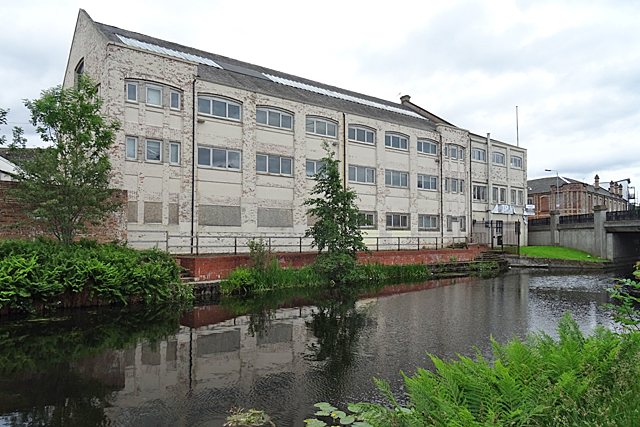
Image: © Anne Burgess Taken: 25 Jun 2019
The first edition of the Ordnance Survey six-inch map shows no buildings alongside the Glasgow Branch of the Forth and Clyde Canal, but the second edition marks industrial developments all along the canal, including these buildings by the bridge carrying Ruchill Street over the canal.
Images are licensed for reuse under creativecommons.org/licenses/by-sa/2.0
Image Location
Latitude
55.887268
Longitude
-4.282813