OS benchmark - Llandrillo, St Trillo's church
Introduction
The photograph on this page of OS benchmark - Llandrillo, St Trillo's church by Richard Law as part of the Geograph project.
The Geograph project started in 2005 with the aim of publishing, organising and preserving representative images for every square kilometre of Great Britain, Ireland and the Isle of Man.

There are currently over 7.5m images from over 14,400 individuals and you can help contribute to the project by visiting https://www.geograph.org.uk
OS benchmark - Llandrillo, St Trillo's church
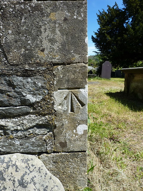
Image: © Richard Law Taken: 15 May 2019
Cut into the southern angle of the church, only a few yards from the rather older Image, and levelled in 1942 at 161.881m above Ordnance Datum Newlyn.
Images are licensed for reuse under creativecommons.org/licenses/by-sa/2.0
Image Location


Leaflet Map data © OpenStreetMap
Latitude
52.92224
Longitude
-3.437987