Llanrhaeadr-ym-Mochnant parish war memorial
Introduction
The photograph on this page of Llanrhaeadr-ym-Mochnant parish war memorial by Richard Law as part of the Geograph project.
The Geograph project started in 2005 with the aim of publishing, organising and preserving representative images for every square kilometre of Great Britain, Ireland and the Isle of Man.

There are currently over 7.5m images from over 14,400 individuals and you can help contribute to the project by visiting https://www.geograph.org.uk
Llanrhaeadr-ym-Mochnant parish war memorial
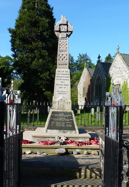
Image: © Richard Law Taken: 15 May 2019
This stone obelisk and the surrounding iron-railed enclosure were Grade II listed https://britishlistedbuildings.co.uk/300081836-parish-war-memorial-at-st-dogfans-church-with-surrounding-railed-enclosure-llanrhaeadr-ym-mochnant#.XQnaWIhKhPY in 2003. The Celtic wheeled cross was originally erected around 1920 to commemorate the 50 parish men who fell in WWI, and a further 4 names were added after WWII.
Images are licensed for reuse under creativecommons.org/licenses/by-sa/2.0
Image Location
Latitude
52.824747
Longitude
-3.301191