Thames boundary obelisk
Introduction
The photograph on this page of Thames boundary obelisk by Robin Webster as part of the Geograph project.
The Geograph project started in 2005 with the aim of publishing, organising and preserving representative images for every square kilometre of Great Britain, Ireland and the Isle of Man.

There are currently over 7.5m images from over 14,400 individuals and you can help contribute to the project by visiting https://www.geograph.org.uk
Thames boundary obelisk
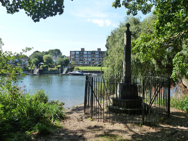
Image: © Robin Webster Taken: 9 Sep 2012
Plated 'Lower limit of Thames Conservancy 1900', this is or was where their administration ended and the Port of London Authority took over. The ubiquitous Environment Agency have now assumed Thames Conservancy powers.
Images are licensed for reuse under creativecommons.org/licenses/by-sa/2.0
Image Location
Latitude
51.434253
Longitude
-0.327588