Paignton buildings [13]
Introduction
The photograph on this page of Paignton buildings [13] by Michael Dibb as part of the Geograph project.
The Geograph project started in 2005 with the aim of publishing, organising and preserving representative images for every square kilometre of Great Britain, Ireland and the Isle of Man.

There are currently over 7.5m images from over 14,400 individuals and you can help contribute to the project by visiting https://www.geograph.org.uk
Paignton buildings [13]
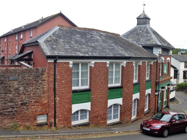
Image: © Michael Dibb Taken: 26 May 2019
Built in the 1860s as a brewery with a tall ventilated malthouse. Partly converted into a shop in the 1982 restoration and now in residential use. Listed, grade II, with details at: https://historicengland.org.uk/listing/the-list/list-entry/1195240
Images are licensed for reuse under creativecommons.org/licenses/by-sa/2.0
Image Location
Latitude
50.437072
Longitude
-3.570305