Parish Boundary, Kew Gardens
Introduction
The photograph on this page of Parish Boundary, Kew Gardens by Des Blenkinsopp as part of the Geograph project.
The Geograph project started in 2005 with the aim of publishing, organising and preserving representative images for every square kilometre of Great Britain, Ireland and the Isle of Man.

There are currently over 7.5m images from over 14,400 individuals and you can help contribute to the project by visiting https://www.geograph.org.uk
Parish Boundary, Kew Gardens
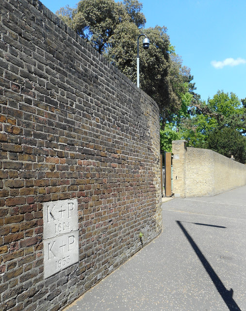
Image: © Des Blenkinsopp Taken: 13 May 2019
Two stones inscribed K + P with the years 1814 and 1933 on the wall around Kew Gardens. I'm guessing these are Kew Parish boundary markers.
Images are licensed for reuse under creativecommons.org/licenses/by-sa/2.0
Image Location
Latitude
51.476891
Longitude
-0.29118