Church Street from above
Introduction
The photograph on this page of Church Street from above by Gordon Hatton as part of the Geograph project.
The Geograph project started in 2005 with the aim of publishing, organising and preserving representative images for every square kilometre of Great Britain, Ireland and the Isle of Man.

There are currently over 7.5m images from over 14,400 individuals and you can help contribute to the project by visiting https://www.geograph.org.uk
Church Street from above
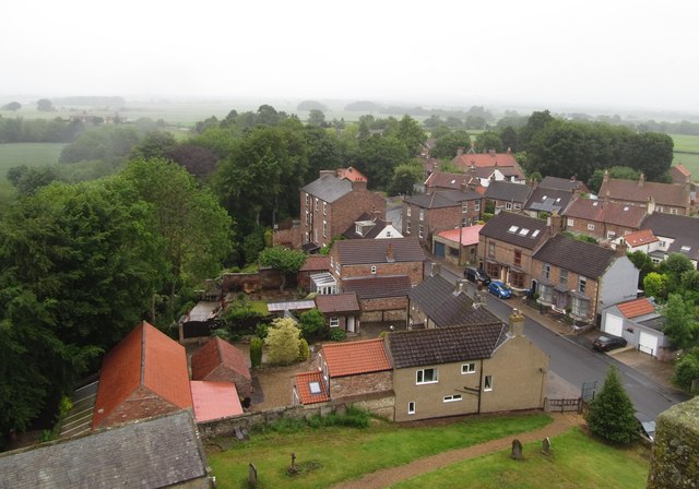
Image: © Gordon Hatton Taken: 8 Jun 2019
Looking down from the top of the church tower into Church Street. In the bottom left hand corner is the roof of the former grammar school, whilst in the centre is the three storey house known as The Mount [grade 2 listed] which was once owned by Joseph Dresser, who also owned the local mill. For many years [pre NHS] it was also the doctor's surgery.
Images are licensed for reuse under creativecommons.org/licenses/by-sa/2.0
Image Location


Leaflet Map data © OpenStreetMap
Latitude
54.179042
Longitude
-1.38896