Private frontage, Castle Lane, Warwick
Introduction
The photograph on this page of Private frontage, Castle Lane, Warwick by Robin Stott as part of the Geograph project.
The Geograph project started in 2005 with the aim of publishing, organising and preserving representative images for every square kilometre of Great Britain, Ireland and the Isle of Man.

There are currently over 7.5m images from over 14,400 individuals and you can help contribute to the project by visiting https://www.geograph.org.uk
Private frontage, Castle Lane, Warwick
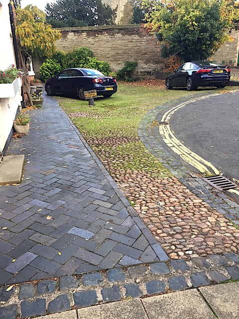
Image: © Robin Stott Taken: 6 Nov 2018
It might seem obvious that the surface treatment of the ground indicates how the space is used or managed: illustrated here. The band of dark grey setts defines a boundary. The yellow-lined tarmac road and the concrete paving slabs in the foreground denote the public highway, the public domain. The rest of the space is private: a handsome path of blue clay pavers reserves and defines the route to residents' front doors. The contrasting material next to it (Bunter pebbles) signals two different functions: parking space for residents, and deterring access by anyone else. The wall in the background denotes the boundary of another private space: Warwick Castle.
Images are licensed for reuse under creativecommons.org/licenses/by-sa/2.0
Image Location
Latitude
52.28053
Longitude
-1.586162