The Green Stone milestone
Introduction
The photograph on this page of The Green Stone milestone by Richard Law as part of the Geograph project.
The Geograph project started in 2005 with the aim of publishing, organising and preserving representative images for every square kilometre of Great Britain, Ireland and the Isle of Man.

There are currently over 7.5m images from over 14,400 individuals and you can help contribute to the project by visiting https://www.geograph.org.uk
The Green Stone milestone
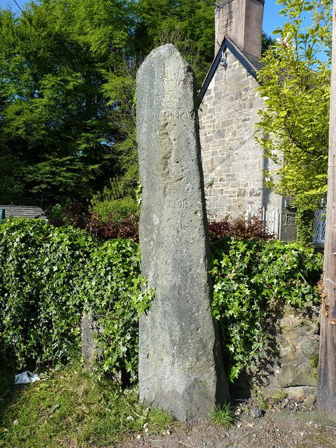
Image: © Richard Law Taken: 15 May 2019
Originally thought to have been a prehistoric menhir (standing stone) but put to more recent use in the late 18th century as a carved milestone. It stood a few yards to the west until the nearby school was built, then moved to the roadside, and was Grade II listed https://britishlistedbuildings.co.uk/300081842-the-green-stone-llanrhaeadr-ym-mochnant#.XOw3NYhKjcs in 2003.
Images are licensed for reuse under creativecommons.org/licenses/by-sa/2.0
Image Location
Latitude
52.823582
Longitude
-3.299272