RAF Dunkeswell: a tour of a WW2 airfield - War Memorial (14)
Introduction
The photograph on this page of RAF Dunkeswell: a tour of a WW2 airfield - War Memorial (14) by Mike Searle as part of the Geograph project.
The Geograph project started in 2005 with the aim of publishing, organising and preserving representative images for every square kilometre of Great Britain, Ireland and the Isle of Man.

There are currently over 7.5m images from over 14,400 individuals and you can help contribute to the project by visiting https://www.geograph.org.uk
RAF Dunkeswell: a tour of a WW2 airfield - War Memorial (14)
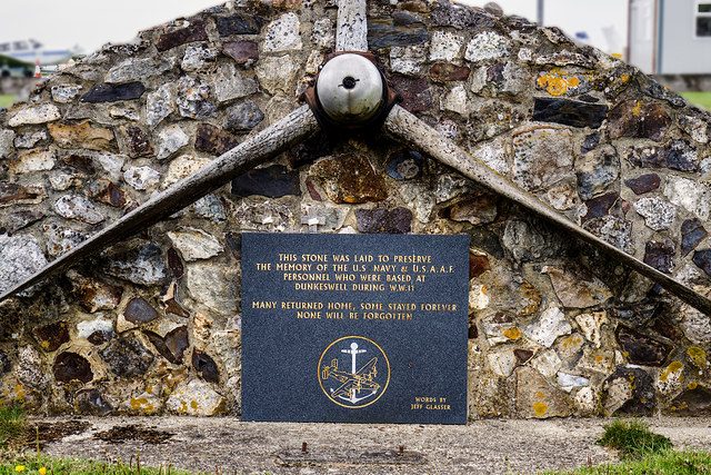
Image: © Mike Searle Taken: 7 May 2019
- For the full histories of RAF Dunkeswell, Upottery and Culmhead see https://www.southwestairfields.co.uk/ START of Tour: Image
Images are licensed for reuse under creativecommons.org/licenses/by-sa/2.0
Image Location
Latitude
50.863787
Longitude
-3.227217