Road closure, St Mildreds Road
Introduction
The photograph on this page of Road closure, St Mildreds Road by John Baker as part of the Geograph project.
The Geograph project started in 2005 with the aim of publishing, organising and preserving representative images for every square kilometre of Great Britain, Ireland and the Isle of Man.

There are currently over 7.5m images from over 14,400 individuals and you can help contribute to the project by visiting https://www.geograph.org.uk
Road closure, St Mildreds Road
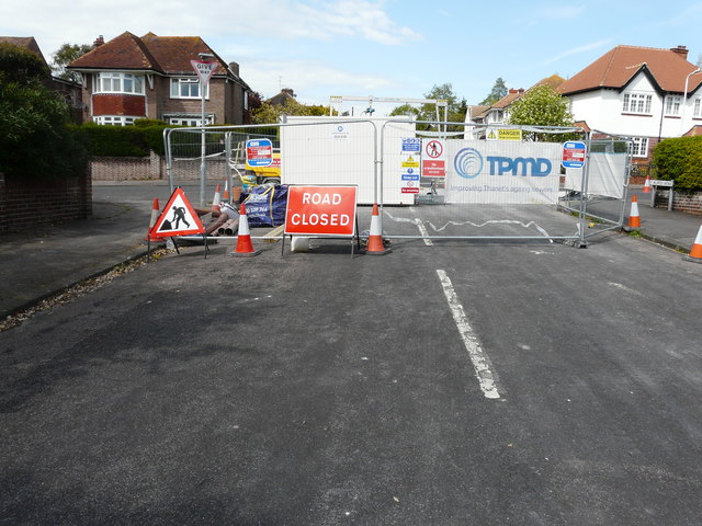
Image: © John Baker Taken: 2 May 2019
The banner reads ‘TPMD Improving Thanet’s ageing sewers’. Southern Water is investing more than £30 million to upgrade Thanet’s ageing sewer network to help protect wildlife and the environment. Constructed by Victorian miners, the original sewer pipes were laid inside chalk tunnels known as adits. Ground surveys and other works will continue this month [October 2018], with the main construction taking place towards the end of this year [2018]. The work is the second of three phases after Southern Water successfully carried out the first phase of works in 2014/15. The new scheme is planned to be completed in early 2020 and will be carried out by TPMD, a team of three specialists – Terra Solutions, Pfeiffer and Matt Durbin Associates https://www.carringtonwest.com/southern-water-invests-30-million-plus-to-upgrade-thanets-ageing-sewers/
Images are licensed for reuse under creativecommons.org/licenses/by-sa/2.0
Image Location
Latitude
51.328928
Longitude
1.400302