RAF Harrowbeer: a tour of a WW2 airfield (1)
Introduction
The photograph on this page of RAF Harrowbeer: a tour of a WW2 airfield (1) by Mike Searle as part of the Geograph project.
The Geograph project started in 2005 with the aim of publishing, organising and preserving representative images for every square kilometre of Great Britain, Ireland and the Isle of Man.
There are currently over 7.5m images from over 14,400 individuals and you can help contribute to the project by visiting https://www.geograph.org.uk

Image: © Mike Searle Taken: 5 May 2019
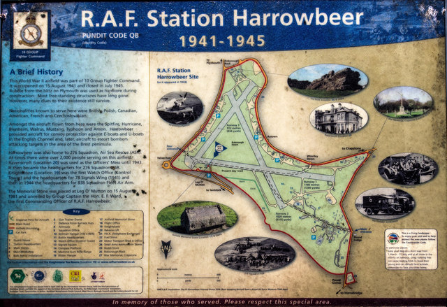
We start and end this tour of the wartime airfield of RAF Harrowbeer at the site of the station's memorial, where a rather weathered notice board gives an illustrated plan and brief history of the station during the wartime operational years of 1941 - 1945. RAF Harrowbeer was a fighter station under 10 Group, and was opened in August of 1941 to become home to many squadrons and nationalities. As well as British, there were Czechs, Poles, Americans, Canadians, Rhodesians, Australians, and many others operating with a variety of different types of aircraft including Spitfires, Hurricanes, Typhoons, Mustangs, Blenheims, Swordfish, Walrus, Lysander etc. RAF Harrowbeer played a vital role during the war by providing air cover for merchant shipping in the English Channel, watching for enemy E-boats and U-boats, operational sorties in the Cherbourg area, and later escort duties to bombers flying on their missions to and from targets in Europe. The station officially closed on 31 July 1945. Image

