Old lime kiln at Will Hill [2]
Introduction
The photograph on this page of Old lime kiln at Will Hill [2] by Gordon Hatton as part of the Geograph project.
The Geograph project started in 2005 with the aim of publishing, organising and preserving representative images for every square kilometre of Great Britain, Ireland and the Isle of Man.

There are currently over 7.5m images from over 14,400 individuals and you can help contribute to the project by visiting https://www.geograph.org.uk
Old lime kiln at Will Hill [2]
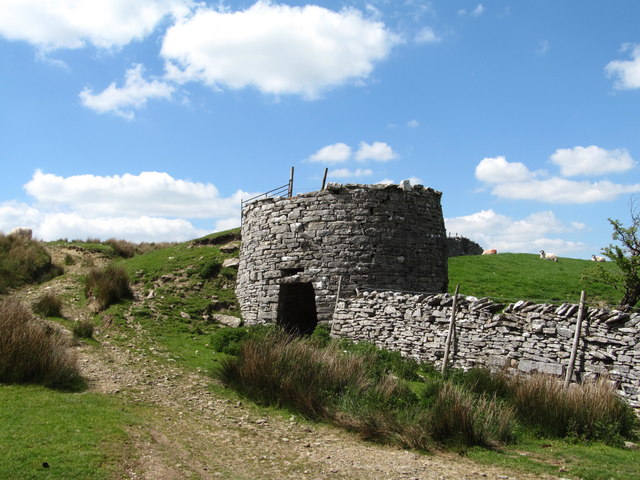
Image: © Gordon Hatton Taken: 16 May 2019
A few yards further along the track and one can see that the lime kiln has two draw arches. The quarry for the limestone is mostly hidden behind and above the kiln, whilst one wonders how close to the geological boundary this limestone is. A glance at the map shows areas such as Tailor Mire only a few hundred metres away, suggesting that the underlying Silurian grits and shales of the Howgills may be the rock type here.
Images are licensed for reuse under creativecommons.org/licenses/by-sa/2.0
Image Location
Latitude
54.434157
Longitude
-2.45582