Robert Palmer's Almshouses
Introduction
The photograph on this page of Robert Palmer's Almshouses by Des Blenkinsopp as part of the Geograph project.
The Geograph project started in 2005 with the aim of publishing, organising and preserving representative images for every square kilometre of Great Britain, Ireland and the Isle of Man.

There are currently over 7.5m images from over 14,400 individuals and you can help contribute to the project by visiting https://www.geograph.org.uk
Robert Palmer's Almshouses
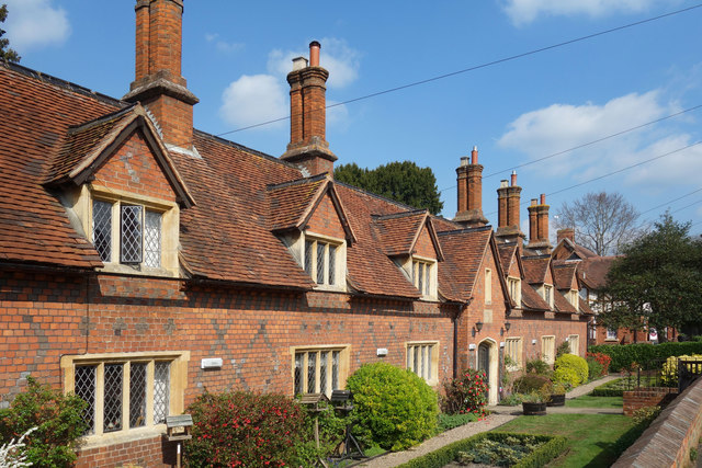
Image: © Des Blenkinsopp Taken: 28 Mar 2019
6 almshouses named after Robert Palmer who was the MP for Sonning in the 1830s and a benefactor to the village.
Images are licensed for reuse under creativecommons.org/licenses/by-sa/2.0
Image Location
Latitude
51.472762
Longitude
-0.909608