Castle Street, Dumbarton
Introduction
The photograph on this page of Castle Street, Dumbarton by Lairich Rig as part of the Geograph project.
The Geograph project started in 2005 with the aim of publishing, organising and preserving representative images for every square kilometre of Great Britain, Ireland and the Isle of Man.

There are currently over 7.5m images from over 14,400 individuals and you can help contribute to the project by visiting https://www.geograph.org.uk
Castle Street, Dumbarton
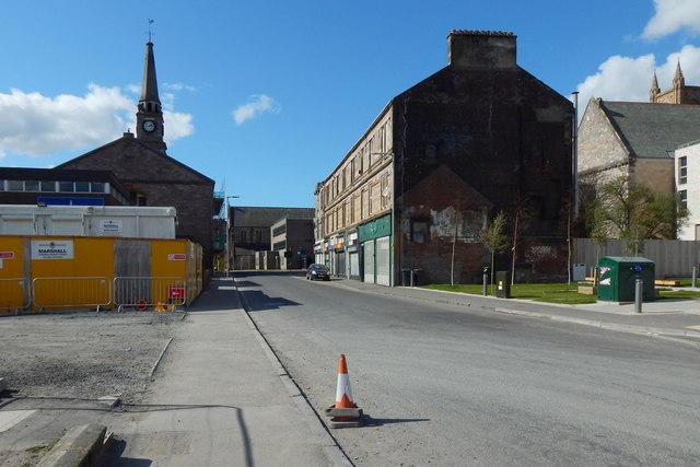
Image: © Lairich Rig Taken: 31 Mar 2019
This is the western end of the street. An earlier picture shows it from further back: Image Much has changed since that picture was taken: the last Image have been demolished (Image / Image), and Image have been built to the right (north) of the road. Image is in the left background, with its church hall in front of it. The outline of a demolished building can be seen on the end-wall just right of centre.
Images are licensed for reuse under creativecommons.org/licenses/by-sa/2.0
Image Location
Latitude
55.943236
Longitude
-4.567015