St. Mary's Roman Catholic Church
Introduction
The photograph on this page of St. Mary's Roman Catholic Church by Mick Garratt as part of the Geograph project.
The Geograph project started in 2005 with the aim of publishing, organising and preserving representative images for every square kilometre of Great Britain, Ireland and the Isle of Man.

There are currently over 7.5m images from over 14,400 individuals and you can help contribute to the project by visiting https://www.geograph.org.uk
St. Mary's Roman Catholic Church
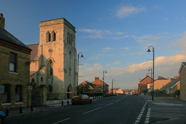
Image: © Mick Garratt Taken: 16 Nov 2007
Durham Street. The church was built in Transitional Norman or ‘First Point Period’ in 1851 at a time when the population of Hartlepool was increasing with an influx of dock and railway workers. The church was designed by Joseph Aloysius Hansom who also designed the Hansom Cab and was paid for by weekly collections from the 1,500 parishioners in the area who also carried the stone from a nearby quarry.
Images are licensed for reuse under creativecommons.org/licenses/by-sa/2.0
Image Location
Latitude
54.696652
Longitude
-1.182143