Bridge End, Warwick, 1971
Introduction
The photograph on this page of Bridge End, Warwick, 1971 by FCG as part of the Geograph project.
The Geograph project started in 2005 with the aim of publishing, organising and preserving representative images for every square kilometre of Great Britain, Ireland and the Isle of Man.

There are currently over 7.5m images from over 14,400 individuals and you can help contribute to the project by visiting https://www.geograph.org.uk
Bridge End, Warwick, 1971
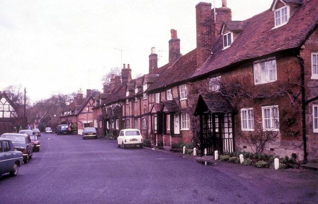
Image: © FCG Taken: Unknown
The terrace of cottages on the right is grade II listed as a group and thought to be of 17th century origins with some 18th century additions.
Images are licensed for reuse under creativecommons.org/licenses/by-sa/2.0
Image Location


Leaflet Map data © OpenStreetMap
Latitude
52.278802
Longitude
-1.580608