
Milestone and bench mark, Downpatrick
Introduction
The photograph on this page of Milestone and bench mark, Downpatrick by Rossographer as part of the Geograph project.
The Geograph project started in 2005 with the aim of publishing, organising and preserving representative images for every square kilometre of Great Britain, Ireland and the Isle of Man.

There are currently over 7.5m images from over 14,400 individuals and you can help contribute to the project by visiting https://www.geograph.org.uk
Milestone and bench mark, Downpatrick
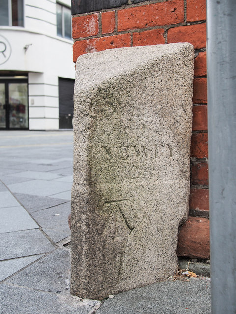
Image: © Rossographer Taken: 3 May 2019
Old milestone on the corner of Scotch Street, Irish Street and Church Street in Downpatrick (outside the old Market House, just about visible on the left hand side of Image). It is very worn but I can make out Newry and the number 24 (I assume that this is the distance from Downpatrick in Irish miles as the distance in statute miles is around 30). Other words and figures may have worn away (there is nothing visible on the reverse side). The stone dates from at least c1840 as the bench mark is recorded in the first geodetic levelling of Ireland 1839-43. The mark is in a line from Dublin to Belfast; it was recorded as the 225th mark in that line. The original remarks describe it as "on Milestone at West side of Downpatrick Market House; 2.2 feet above centre of road". The mark was originally levelled to 29.300 feet above sea level, later revised to 29.6 feet but apparently disused after 1950 as it does not appear on any maps from then onwards.
Images are licensed for reuse under creativecommons.org/licenses/by-sa/2.0
Image Location

Latitude
54.328841
Longitude
-5.715898