Harding monument, South Petherton
Introduction
The photograph on this page of Harding monument, South Petherton by Derek Harper as part of the Geograph project.
The Geograph project started in 2005 with the aim of publishing, organising and preserving representative images for every square kilometre of Great Britain, Ireland and the Isle of Man.

There are currently over 7.5m images from over 14,400 individuals and you can help contribute to the project by visiting https://www.geograph.org.uk
Harding monument, South Petherton
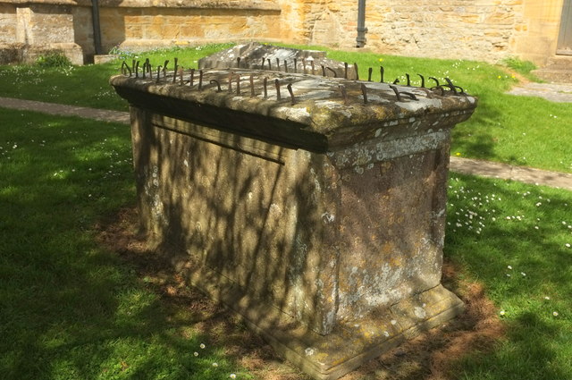
Image: © Derek Harper Taken: 27 Apr 2019
"Chest tomb. Circa 1700, adapted in early C19. Ham stone. ... heavy shallow-hipped top with rounded leading edges, with wrought-iron spikes set in all round" https://historicengland.org.uk/listing/the-list/list-entry/1294826 . In the churchyard of St Peter and St Paul's - the church is visible in the background.
Images are licensed for reuse under creativecommons.org/licenses/by-sa/2.0
Image Location
Latitude
50.948188
Longitude
-2.80921