Mill Bridge, Isleworth
Introduction
The photograph on this page of Mill Bridge, Isleworth by Andrew Curtis as part of the Geograph project.
The Geograph project started in 2005 with the aim of publishing, organising and preserving representative images for every square kilometre of Great Britain, Ireland and the Isle of Man.

There are currently over 7.5m images from over 14,400 individuals and you can help contribute to the project by visiting https://www.geograph.org.uk
Mill Bridge, Isleworth
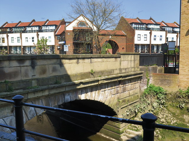
Image: © Andrew Curtis Taken: 21 Apr 2019
The bridge forms part of the Isleworth Mill River (or Duke of Northumberland's River), a 16th century mill stream. A mill formerly stood on the west side of the basin over the arches. This bridge was built at the expense of the Duke of Northumberland in 1820. The bridge is a good example of Neoclassical masonry and, with the basin, forms a notable survival from Isleworth's industrial past. It is a Grade II Listed Building (List Entry Number: 1389410) https://historicengland.org.uk/listing/the-list/list-entry/1389410
Images are licensed for reuse under creativecommons.org/licenses/by-sa/2.0
Image Location
Latitude
51.470508
Longitude
-0.322375