RAE Bedford
Introduction
The photograph on this page of RAE Bedford by Martin Addison as part of the Geograph project.
The Geograph project started in 2005 with the aim of publishing, organising and preserving representative images for every square kilometre of Great Britain, Ireland and the Isle of Man.

There are currently over 7.5m images from over 14,400 individuals and you can help contribute to the project by visiting https://www.geograph.org.uk
RAE Bedford
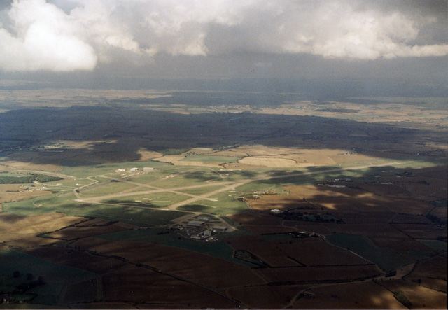
Image: © Martin Addison Taken: 11 Oct 1989
Originally opened as RAF Thurleigh, this airfield became the testing ground of the Royal Aircraft Establishment and was still in use when this photo was taken. The main runway was extended to its present length to accommodate the Bristol Brabazon airliner, which needed a lot of runway to get airborne. The RAE consolidated its resources at Boscombe down and the airfield closed in 1994. Once proposed as another airport for London, it is now a business park and new vehicle store.
Images are licensed for reuse under creativecommons.org/licenses/by-sa/2.0
Image Location
Latitude
52.22951
Longitude
-0.474894