Ty Basket, Usk
Introduction
The photograph on this page of Ty Basket, Usk by Eirian Evans as part of the Geograph project.
The Geograph project started in 2005 with the aim of publishing, organising and preserving representative images for every square kilometre of Great Britain, Ireland and the Isle of Man.

There are currently over 7.5m images from over 14,400 individuals and you can help contribute to the project by visiting https://www.geograph.org.uk
Ty Basket, Usk
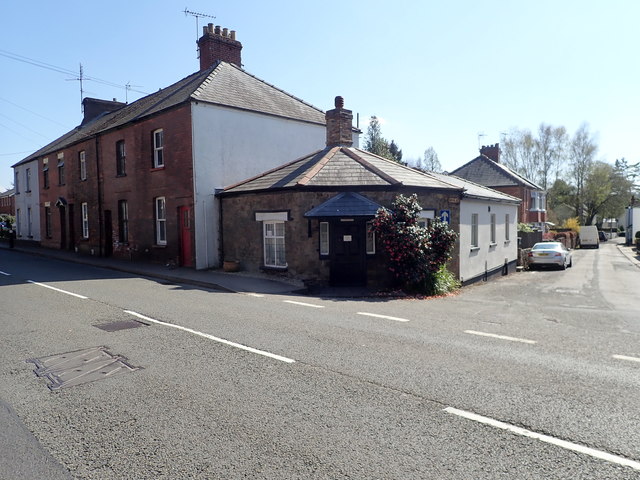
Image: © Eirian Evans Taken: 13 Apr 2019
Former Turnpike toll house. The Monmouth road was constructed under the Usk Turnpike Act just prior to the Tithe Map of 1846. Its original use finished in 1880.
Images are licensed for reuse under creativecommons.org/licenses/by-sa/2.0
Image Location
Latitude
51.704461
Longitude
-2.900925