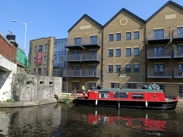
Grand Union Canal pillbox, Uxbridge
Introduction
The photograph on this page of Grand Union Canal pillbox, Uxbridge by Andrew Curtis as part of the Geograph project.
The Geograph project started in 2005 with the aim of publishing, organising and preserving representative images for every square kilometre of Great Britain, Ireland and the Isle of Man.
There are currently over 7.5m images from over 14,400 individuals and you can help contribute to the project by visiting https://www.geograph.org.uk

Image: © Andrew Curtis Taken: 19 Apr 2019
The concrete pillbox nestles below the bridge of St John's Road on the east side of the canal which it appears to have guarded. New apartments at Waterloo Wharf can be seen behind the barge. Another pillbox is known just south Image In 2016, the remains of a World War 2 pillbox were unearthed close to the Grand Union Canal in Cowley, in the London Borough of Hillingdon. The fortifications along this part of the Grand Union Canal formed a section of the 'Outer London Defence Ring'. Fabricated in reinforced concrete, the pillboxes included embrasures from which soldiers (usually of the Home Guard), armed with rifles or light machine guns, could fire on advancing enemy troops.

